
Advanced Search for Maps
Showing 1-2 of 2
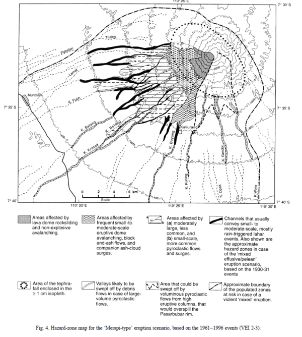
Figure in a journal article
Hazard-zone map for the 'Merapi-type' eruption scenario, based on the 1961-1996 events (VEI 2-3)
Figure 4 in: Thouret, J.-C., Lavigne, F., Kelfoun, K., & Bronto, S. (2000). Toward a revised hazard assessment at Merapi volcano, Central Java. Journal of Volcanology and Geothermal Research, 100(1-4), p. 479-502. https://doi.org/10.1016/S0377-0273(00)00152-9
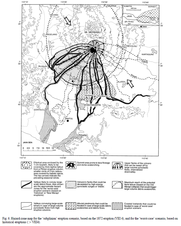
Figure in a journal article
Hazard-zone map for the 'subplinian' eruption scenario, based on the 1872 eruption (VEI 4), and for the 'worst-case' scenario, based on historical eruptions (>VEI 4)
Figure 6 in: Thouret, J.-C., Lavigne, F., Kelfoun, K., & Bronto, S. (2000). Toward a revised hazard assessment at Merapi volcano, Central Java. Journal of Volcanology and Geothermal Research, 100(1-4), p. 479-502. https://doi.org/10.1016/S0377-0273(00)00152-9